

![]() Advanced Computer Systems A.C.S. S.p.A. (ACS) is an Italian SME based in Rome (HQ) and Matera (R&D Center). Founded in 1979, the company owns a solid experience in software solutions and integrated systems for Earth Observation (EO) data management and added value environmental applications. ACS core business, represented by ACS Space Division, is the design and development of Ground Segment systems and facilities for EO data acquisition, processing, archiving and dissemination.
Advanced Computer Systems A.C.S. S.p.A. (ACS) is an Italian SME based in Rome (HQ) and Matera (R&D Center). Founded in 1979, the company owns a solid experience in software solutions and integrated systems for Earth Observation (EO) data management and added value environmental applications. ACS core business, represented by ACS Space Division, is the design and development of Ground Segment systems and facilities for EO data acquisition, processing, archiving and dissemination.
Multi-satellite Data Processing System (MDPS) is one of the company leading products, capable to concurrently handle several satellite missions such as Landsat 1-7, SPOT 1-4, ERS-1/2, JERS, XSAR, NOAA AVHRR, MOS-1, Terra- MODIS, ENVISAT, RADARSAT, CryoSat, GOCE. Counting on 30 years of experience, ACS has a key role in the EO market having its systems and facilities installed in more than 25 countries around the globe.
The specific know how related to Ground Segment development has been growing in parallel with the capacity to develop remote sensing data applications. These applications study natural and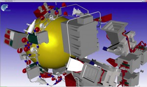 anthropic phenomena. The applications developed by ACS Environment Division include: monitoring of marine environment, vegetation, volcano eruptions, desertification; forest mapping, environmental risks and disaster prevention, cartography, DEM production, urban expansion control in coastal zones, applied Interferometry, Web-based user applications, EO Image Information Mining. Both Space and Environment Divisions rely on internal highly specialized team (ACS Studio) for visualization of scientific data and real time 3D navigation.
Since 1979 ACS develops system for Earth Observation data acquisition, processing and distribution. Working closely for – and with – the European Space Agency ESA, Eumetsat and several national space agencies, including ASI (Italy), DLR (Germany), CNES (France), CONAE (Argentina), IAI (Israel) and, recently, the European Maritime Security Agency, the 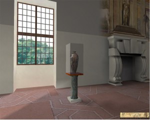 company owns a solid know how in EO data management projects and services.
ACS is currently involved in the development of the Payload Data Ground Segments of Sentinel-1, Sentinel-2 and Sentinel-3.
Starting from the experience accumulated in image processing ACS started, at the end of the 90’s a department specifically devoted to 3D-4D applications and Virtual Reality. In this sector ACS developed the system VRES for ESA, which allows scientists to merge EO data, geographical data, local measurements and Digital Elevation Models in order to build 4D shows for the scientific community and the broad public. ACS designed and implemented two Virtual Rality Theatres at the ESA-ESRIN premises in Frascati.
The experience of ACS in 3D rendering engines has also been applied to the archaeological sector and to TV broadcasting. Recently ACS has started the development of Augmented Reality systems for ESA and for the maritime sector. ACS is certified developer for Oculus Rift since 2013 and keeps experimenting and developing applications for all the available AR devices.
For further details on 3D experience of ACS consult http://acsstudio.acsys.it.
Comments are closed.